Twin Peak Day 1 - Platt Fields and Fallowfield Campus
Northwest Sprint Championships
A 2-part Sprint race in Platt Fields Park and the nearby Fallowfield Campus of the University of Manchester. Open to runners from any region.
Sat 14th Jun 2014
Type of event: National, Sprint
Type of terrain: Parkland, Urban
Info updated: 21st Mar
Results
Event Report
Northwest Sprint Champions
| Class | Name | Class | Name |
|---|---|---|---|
| W10 | - | M10 | - |
| W12 | Anna Harris DEE | M12 | Finlay Johnson SROC |
| W14 | Hannah Hateley DEE | M14 | James McCann MDOC |
| W16 | Laura Hindle MDOC | M16 | Jack Cryer PFO |
| W18 | Sarah Jones LOC | M18 | Matthew Fellbaum MDOC (M16) |
| W20 | - | M20 | Oliver Williams DEE |
| W21 | Elspeth Ingleby SELOC | M21 | James Walsh SROC |
| W35 | - | M35 | Mike Johnson SROC (M50) |
| W40 | Debra Hoyle PFO | M40 | Paul Watson MDOC |
| W45 | Jane McCann MDOC | M45 | Nick Howlett LOC |
| W50 | Susan Harding SROC | M50 | Jon Hateley DEE |
| W55 | Jackie Chapman LOC | M55 | Paul Turner SELOC |
| W60 | Jean Payne DEE | M60 | John Britton MDOC |
| W65 | - | M65 | Mike Smithard DEE |
| W70 | Rae Lomas MDOC | M70 | Robert Verity DEE |
| W75 | Sue Birkinshaw MDOC | M75 | - |
| W80 | - | M80 | Alan Heron SELOC |
Pre Event Info
Twin Peak 2014 - Notes applicable to both days
Twin Peak 2014 will comprise of two level B events, both within the City of Manchester, and easily accessible by public transport.
Saturday 14 June. Northwest Sprint Championships. A 2-part Sprint race in Platt Fields Park and the adjacent Fallowfield Campus of the University of Manchester.
Sunday 15 June. City of Manchester Race. A full length urban event in central Manchester, centred on the Castlefield Arena. This event is included in the UK Urban League.
Courses.There will be 7 competitive courses each day:
| Course | Men's classes | Women's classes |
|---|---|---|
| 1 | Men Open | |
| 2 | Vet Men (M40+) | Women Open |
| 3 | Super Vet Men (M55+) | Vet Women (W40+) |
| 4 | Ultra Vet Men (M65+) | Super Vet Women (W55+) |
| 5 | Ultra Vet Women (W65+) | |
| 6 | Junior Men (M16-) | Junior Women (W16-) |
| 7 | Young Junior Men (M12-) | Young Junior Women (W12-) |
Twin Peak prizes will be awarded to the leading runner in each different age class over the two days. Competitors may enter any course they wish, but will only be eligible for Twin Peak prizes if they enter their correct or a longer course on both days. Times for the Sprint Qualifier, Sprint Final and Urban Race will be added together.
Notes for those new to Sprint and Urban Orienteering:
 You may choose any course, depending on how far you want to run (or walk). Trainers, t-shirt and shorts are fine for competing. We provide a map and an electronic timing card. The map is not difficult to interpret, just remember that yellow represents grass, green dots for individual trees or bushes, blocks of green for thick vegetation, white for runnable woodland and beige for roads or pavements. Light grey shows a canopy or underpass.
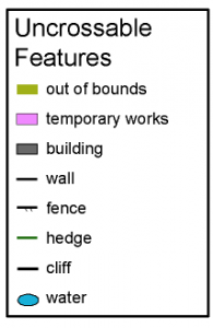
You must not cross: thick black lines (walls or fences), dark grey (buildings), olive-green (private gardens or flowerbeds), or solid areas of blue (canals, rivers or lakes). Other out of bounds areas are shown by solid purple (construction work) or closely-spaced vertical red-purple lines. In general, a thick black line represents a feature that is impassable, i.e. must not be crossed, whether or not it looks crossable.
The most common symbols for Uncrossable Features are shown on the right.
Map Symbols: The full set of symbols used on the maps for both days is shown here: (symbols)
SI electronic punching will be used. SI cards may be hired each day. There is no charge, but a cost of £30 will be charged if the card is lost.
Entries: via Fabian4, www.fabian4.co.uk - please read the additional entry information regarding Fabian4 entries.
Fees: (up to Fri. 6 June)
| Saturday | Sunday | Both days | |
|---|---|---|---|
| Seniors | £5 | £9 | £12 |
| Juniors | £3 | £5 | £6 |
Online entry will be possible up to Wed. 11 June at a surcharge of £2 per day for Seniors (no extra for Juniors).
EOD will also be possible at the same surcharged rate, provided maps are available.
Traders: Compass Point will have a stall at Assembly on Saturday. There will be no traders on Sunday.
Accommodation: There is plenty of accommodation available in Manchester. Contact:
Manchester Visitor Information Centre, Piccadilly Plaza, Portland Street, Manchester, M1 4BT. 0871 222 8223 www.visitmanchester.com/stay
The Castlefield Hotel (www.castlefield-hotel.co.uk), which is the event centre for the City of Manchester Race on the Sunday, is offering 10% discount to any competitors staying in the hotel for the event. This includes full use of the gym and swimming pool in the adjacent Y-Club, with which it is linked.
Other nearby accommodation includes the YHA (www.yha.org.uk/hostel/manchester)
Weekend Co-ordinator: Andrew Gregory (MDOC). Enquiries to:
[Day 2 - City of Manchester Race
Detail can be found on the Twin Peak Day 2 - City of Manchester Race event page.]
Day 1 - Northwest Sprint Championships
This is the inaugural year of the Northwest Sprint Championships. The event is open to all, but awards will be given to the top runner from a NW club in each BOF age class (see below). The courses for the Qualifier and Final have each been planned to have an expected winning time of 12-15 minutes.
Awards. There will be medals for NW Sprint Champions for each BOF age group. These will be awarded to the highest placed finisher from a NW club in the A Final. If no-one meets this requirement then the highest placed finisher in the B Final who also completed the Qualification race will receive the award. It is planned to have the award ceremony at 3:15pm.
Location

Nearest town: Fallowfield, Manchester
- Grid Ref: SJ857941
- Postcode: M14 6HD
- Latitude: 53.44418
- Longitude: -2.21408
- Google Map
- Streetmap (OS 50k)
- Bing Map (OS 50k)
- OpenStreetMap
Directions / Parking
Assembly and Registration will be at the Source Café of the Fallowfield Campus. The address is Owens Park, 293 Wilmslow Road, M14 6HD.
Parking: In streets adjacent to Fallowfield campus and Platt Fields. It is recommended to use Old Hall Lane off Wilmslow Road or the area bounded by Langley Road, Albion Road and Landcross Road on the west side of Wilmslow Road opposite the campus. DO NOT use Platt Fields car park. The park is strictly out of bounds to competitors before the event. Parking will not be signed to avoid confusion with signs to Assembly.
Buses: 41, 42, 43, 44, 142, 143 & 157 along Wilmslow Road stop at Owens Park.
Registration & Start Times
All competitors must first report to Assembly in the Source Café to collect number, control descriptions and food/drink voucher. The number should be kept for the Sunday event if you are also competing in that. To reach the Assembly area, use the main entrance off Wilmslow Road about 250m south of the junction with Old Hall Lane. The route to Assembly will be signed from this junction. It is ESSENTIAL that you enter by the signed entrance and do not take any short cuts through the campus, as this is OUT OF BOUNDS before your Final run. The Assembly is in a large room with tables, chairs, EOD, download, toilets, area to leave kit, first aid and an on-line real time results display.
Qualification: Platt Fields. The Start will be signed from Assembly and is 10-15 minutes walk. Allow time to cross Wilmslow Road at the Pelican crossing, and follow signs along Langley/Mabfield Roads. DO NOT attempt any short cuts as the park is out of bounds until after the Qualifier. Starts will be from 11:45 to 12:45. It is a punching start with a 3 minute call-up. After finishing, competitors return across the road to the café to download, and should do so by 1:30. The walk back to Assembly should take about 5 minutes, crossing Wilmslow Road at the same Pelican crossing. Wilmslow Road is busy, children should be accompanied.
Final: Fallowfield Campus. Starts will be from 2:00 to 3:00. For each Course the top 10 men and top 10 women in the Qualification race run in reverse order (10th place goes first …). This is the A final. Everyone else runs in a random order in the B final. Results will be declared separately for the A and B finals. The Start is about 2 minutes walk from Assembly, within the campus. The Finish is adjacent to Assembly.
Course Information
| Course | Men's classes | Women's classes | Qualifying | Final | ||
|---|---|---|---|---|---|---|
| length | controls | length | controls | |||
| 1 | Men open | 2.9 | 21 | 2.6 | 24 | |
| 2 | M40+ | Women Open | 2.6 | 22 | 2.4 | 23 |
| 3 | M55+ | W40+ | 2.3 | 15 | 2.1 | 17 |
| 4 | M65+ | W55+ | 1.9 | 16 | 1.6 | 17 |
| 5 | W65+ | 1.5 | 15 | 1.4 | 14 | |
| 6 | M16- | W16- | 2.7 | 19 | 2.3 | 20 |
| 7 | M12- | W12- | 1.7 | 11 | 1.4 | 16 |
Explanation of colour courses
- White are very easy with all controls on paths. They are mainly used by 6-10 year olds and family groups.
- Yellow use simple linear features like paths, walls and streams. They are mainly used by under 12’s and family groups.
- Orange progress to basic use of the compass and route choice. They are ideal for novice adults or experienced youngsters.
- Light Green are ideal for improvers as the navigational difficulty begins to increase and uses simple contours and point features.
- Green are used mostly by experienced under 18’s and adults wanting a short but challenging course with a very hard navigational difficulty.
- Blue are a longer, more physically demanding course in comparison to the green. The distances are more varied between controls and the course attracts experienced orienteers.
- Brown & Black are very physically demanding and have a very hard navigational difficulty. They are for experienced orienteers only.
- Score means visiting as many controls as possible in any order in a specific time, like 45mins.
Terrain Description
Platt Fields is a relatively flat city park with a central lake and a stream that must only be crossed by bridges. There are large areas of grass, small hills, gardens, many trees and bushes, sports areas and buildings including Platt Hall which contains a Gallery of Costume.
The Fallowfield Campus includes student accommodation blocks, the Armitage Sports Centre and University Sports Grounds. There are many partially enclosed courtyards, bushes, trees, gardens and narrow passageways.
Maps. The maps are A4 size, at a scale of 1:5,000 (Platt Fields) and 1:4,000 (Fallowfield), both with 2.5m contours. They have been updated to ISSOM standard.
Note in particular the features that it is forbidden to cross.
Copies of previous maps are available: Platt Fields (map); Fallowfield Campus (map)
Map notes. Lamp posts and telegraph poles have been deleted from the two maps.
Where individual trees are mapped a small green dot symbol has been used, regardless of size, and the same symbol is used for a bush.
Contacts / Officials
Planners: John Kewley & Ian Gilliver (MDOC)
Organiser: Alison Doyle (MDOC)
Controller: Henry Morgan (POTOC)
Safety and Risk
A comprehensive risk assessment will have been carried out by the organiser, but participants take part at their own risk and are responsible for their own safety during the event.
Privacy: when entering our events your name may appear in the results section of this website or in newspaper reports.
Read our privacy policy to see how we look after your personal data.