Irwell Valley
Near: Prestwich
Terrain
Parkland, Woodland
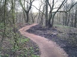
Irwell Valley consists of Ringley and Hurst Woods north of the M60 and Philips and Prestwich Parks south of the M60. There is a footbridge over the M60 linking the 2 areas.
Parkland with some steep wooded slopes in the north and east of the areas.
Also has a permanent orienteering course in Philips Park. See the GMOA website for details.
Location
Nearest town: Prestwich
- Grid Ref: SD773048
- Postcode: M26 1DY
- Latitude: 53.53815
- Longitude: -2.33877
- Google Map (aerial)
- Streetmap (OS 50k)
- Bing Map (OS)
- OpenStreetMap